
Return to You’re in high school now
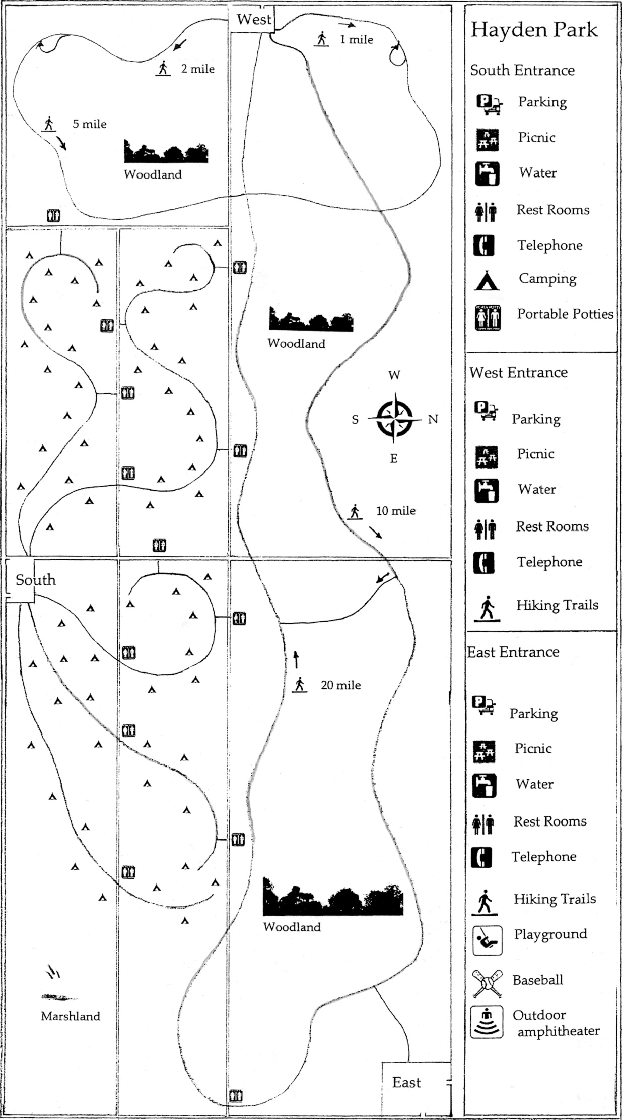
Hayden Park was a combination City/County operation. The vast plot of woodland, five miles long and two miles wide, was honeycombed with trails; daytime picnic and recreation areas could handle large groups; 60 overnight camping sites were accessible by trail. These were arranged and spaced to assure privacy, but not isolation. Campfires were allowed in season, but campers were expected to provide their own fuel and use the designated campfire rings. A few single lane safety roads made maintenance and fire control possible. These were not open to the public. No motorized vehicles were allowed. It was possible to spend a weekend remote from civilization virtually in the middle of town—the only missing ingredient was a mountain stream. Three parking areas provided running water and restroom facilities, as well trail end drop off points; these allowed people to use the camping areas without having to leave their cars overnight. Attempts to connect the camp areas to city water and sewer had failed twice at the ballot box. Campers had to pack in their water; portable chemical toilets were strategically located along the access roads. There was no staff, no reservations—it was first come first served, year around. No firearms were allowed and hunting was prohibited.
In 1886 Joshua Hayden deeded the land to the city and county with the stipulation that it be developed for recreation only; it was never to be sold or divided. It came with a private trust fund dedicated to assure its maintenance; even during the Depression the fund prospered. Thus, the park cost the taxpayers nothing, other than a Sheriff's safety patrol on major holiday weekends. The community took pride in keeping it safe and clean; it had always operated on the honor system. Originally located at the north edge of town, by 1950 it was surrounded by suburbs.
Hayden Park Map is in Chapter 12
Back to top of page